Explore the 1623 map of Deptford
This is a map of Deptford as it appeared in 1623, with later notes by John Evelyn in the margins. An anonymous surveyor’s working sketch of a town that no longer exists in this form. Zoom in to read the field names, find Sayes Court, and follow the streets. Double-click or pinch to zoom on desktop; double-tap or pinch on mobile.
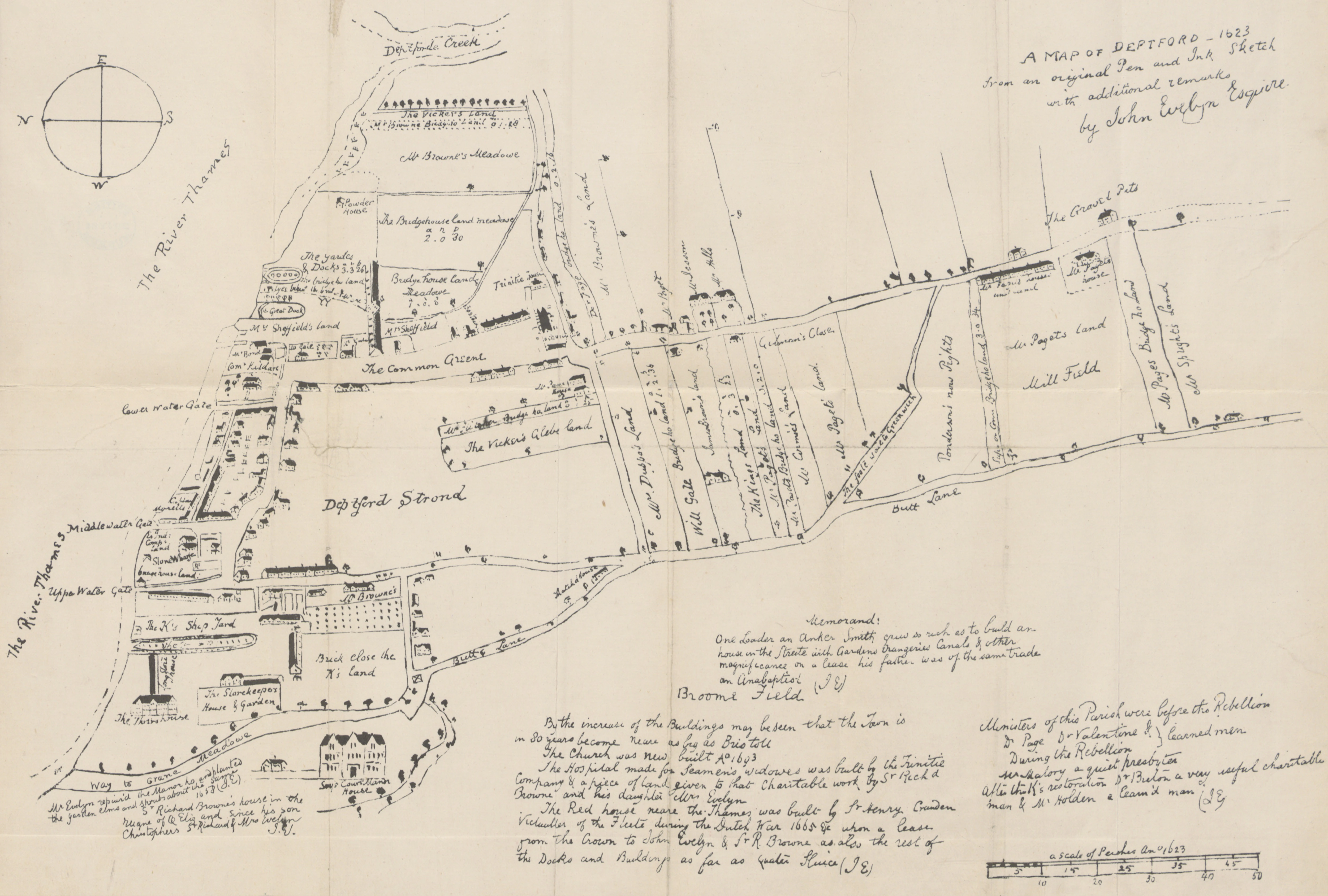
Want the full story? Read how we navigated Deptford using this map and what remains there after four centuries.
References
- Map of Deptford in 1623. From The History Of Deptford by Nathan Dews
- Map Of Deptford, 1623. Ideal Homes: A History Of South-East London Suburbs
- Kent: Deptford, 1623. Catalogue of British Town Maps
%27_(11166594844).jpg)
Support my work by subscribing to Hypertextual, a newsletter about science and big ideas.